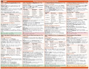
The chart on the previous page is designed to be just an introduction to the
process with relatively simple responses and is not meant to include all possible
answers. The depth and quality of responses should improve as you develop a
deeper understanding of human geography. Throughout the text, references
will be made to the different levels by using Ll, L2, L3, or L4.
Essential Geography Skill Categories 1-5
The AP® Human Geography exam will require students to not only learn the
content and discipline-specific language of the course, but utilize and apply a
set of essential skills to demonstrate their understanding of human geography.
This section introduces these skills and prepares students to apply these skills
using real world scenarios across all units of the course and both parts of the
exam.
Skill Category 1: Concepts and Processes
Analyze geographic theories, approaches, concepts, processes, or models in
theoretical and applied contexts.
This skill contains a large amount of the content of the course and is the most
tested skill on the exam:
• Analyze means to break down into parts and study each part carefully.
• A
theory is a system of ideas and concepts that attempt to explain and
prove why or how interactions have occurred in the past or will occur in
the future.
• Concepts are key vocabulary, ideas, and building blocks that geographers
use to describe our world.
• Processes involve a series of steps or actions that explain why or how
geographic patterns occur.
Models in Geography The most important element of this skill involves
understanding and applying geographic models. Geographers, similar to
biologists, meteorologists, and others who deal with complex reality, create
geographic models.
Models are representations of reality or theories about
reality, to help geographers see general spatial patterns, focus on the influence
of specific factors, and understand variations from place to place. Models help
explain, describe, and sometimes even predict spatial activity and phenomena.
There are two basic types of geographic models-spatial and nonspatial:
• Spatial models look like stylized maps, and they illustrate theories about
spatial distributions. Spatial models have been developed for agricultural
and urban land use, distributions of cities, and store or factory location.
• Nonspatial models illustrate theories and concepts using words, graphs,
or tables. They often depict changes over time rather than across space
with more accuracy than spatial models.
UNIT 1: THINKING GEOGRAPHICALLY 3